Photos & video from the property
Media gallery
Rides, projects, and life on the ridge. Play everything right here on your phone or desktop, or download the originals.
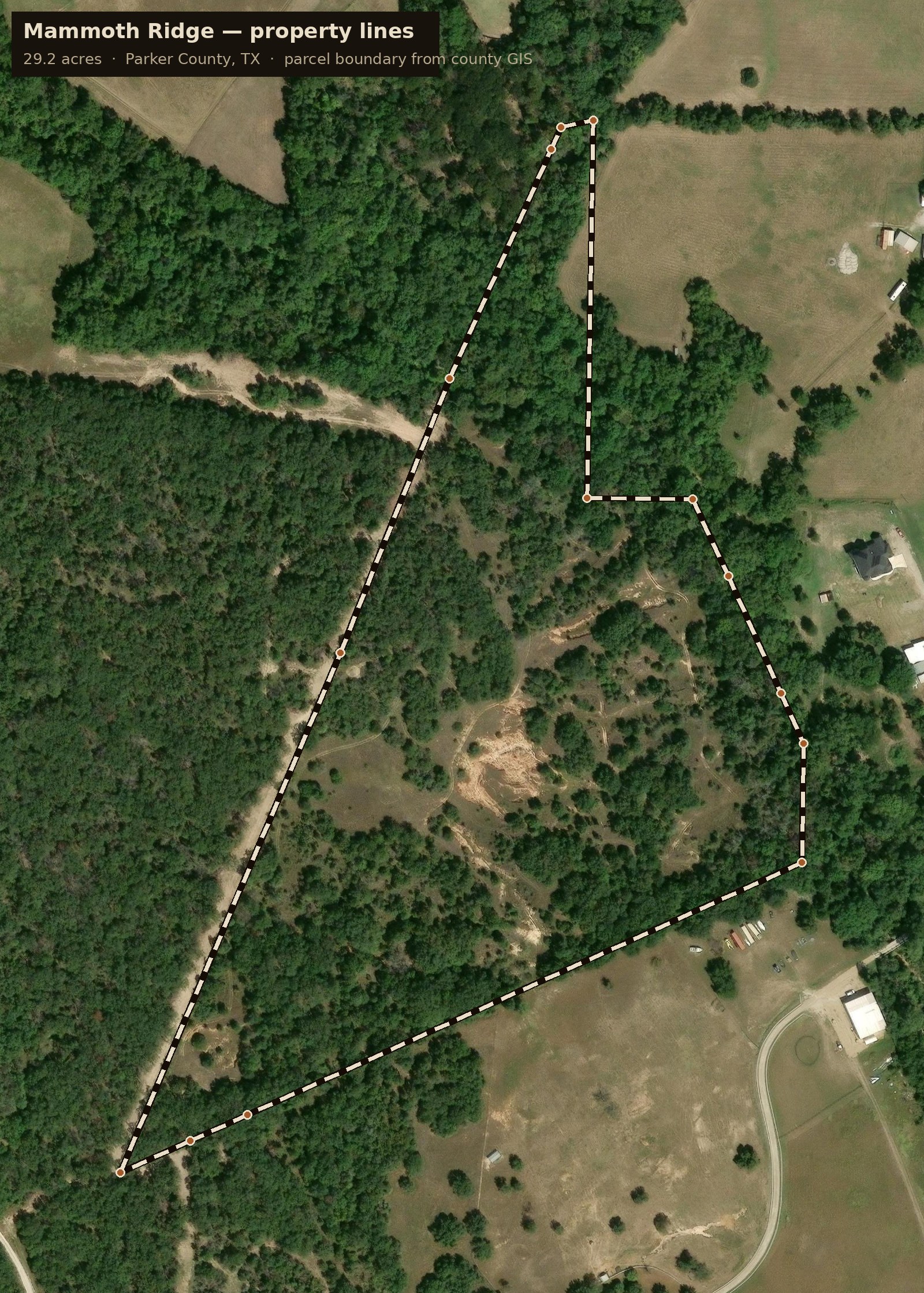
The property lines — 29.2 acres in Parker County, from county GIS
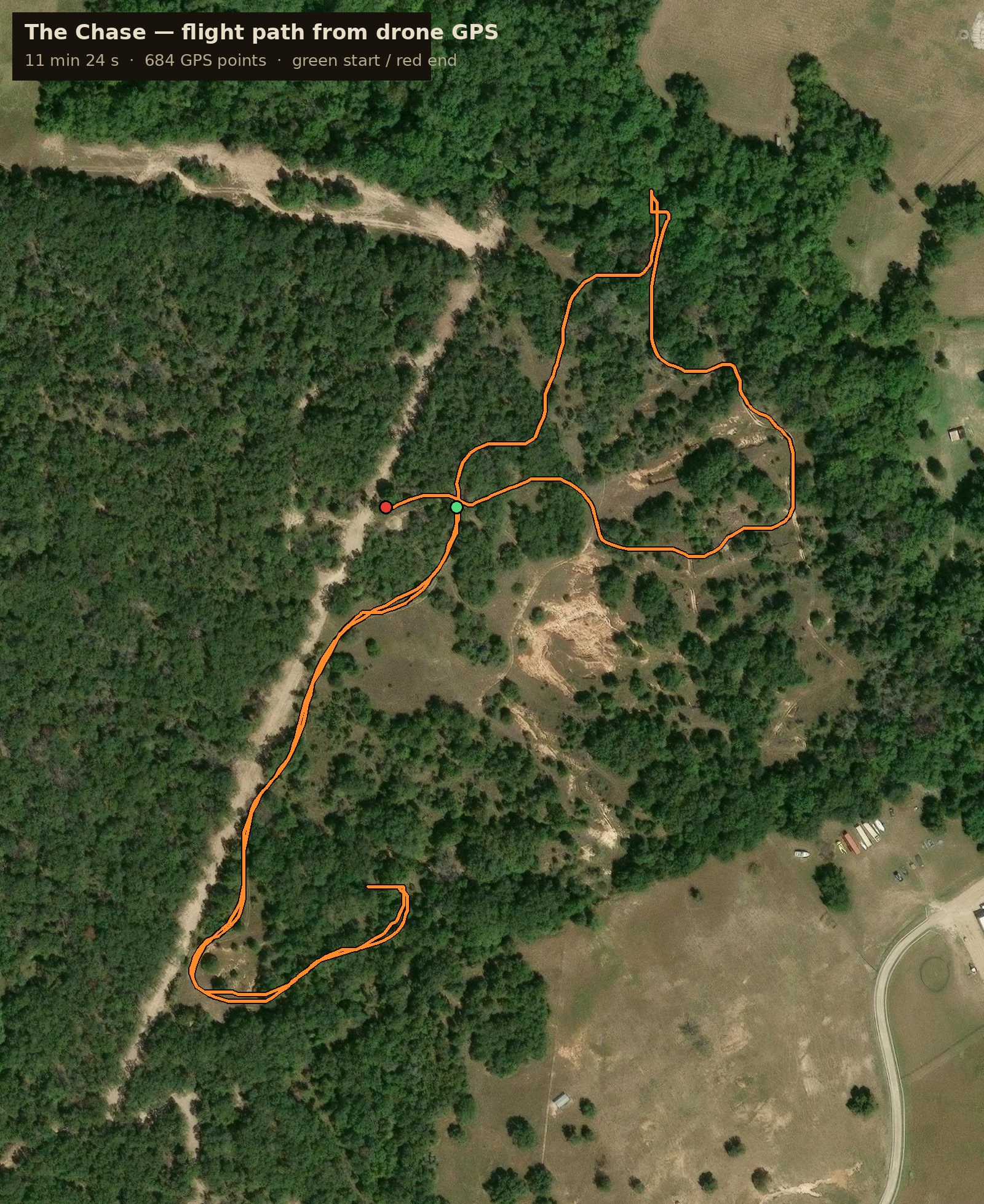
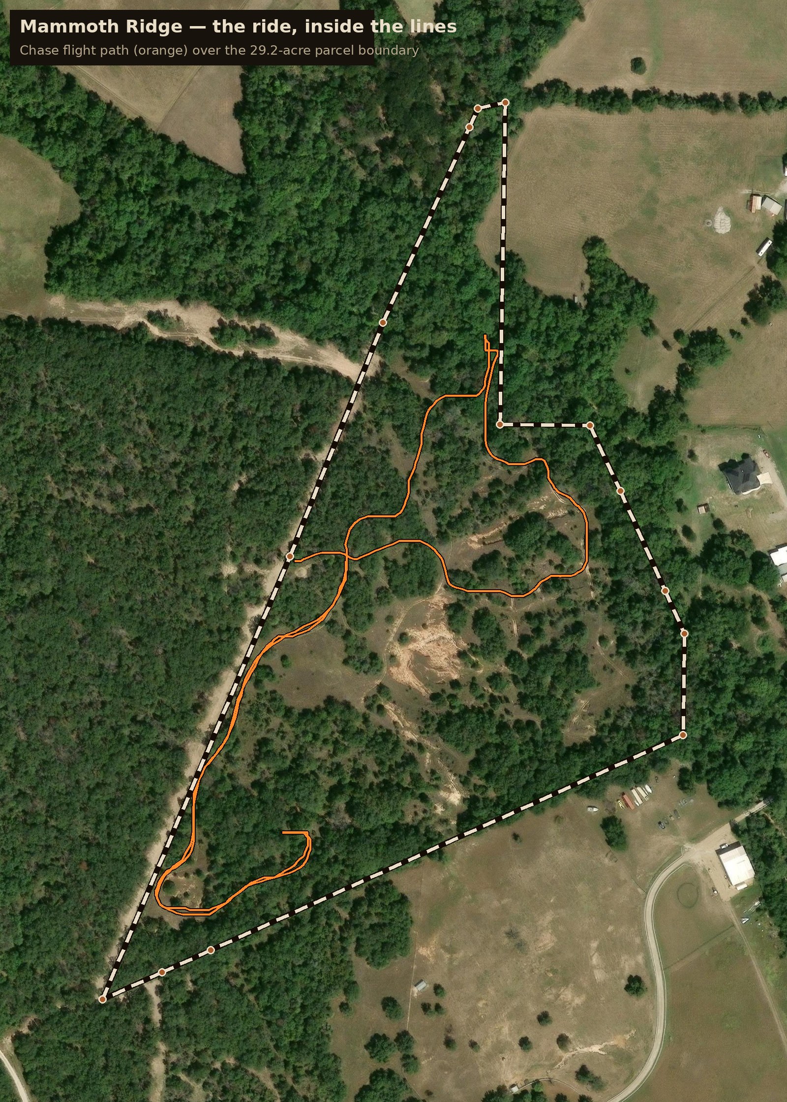
The Chase, mapped — full GPS path pulled from the drone video
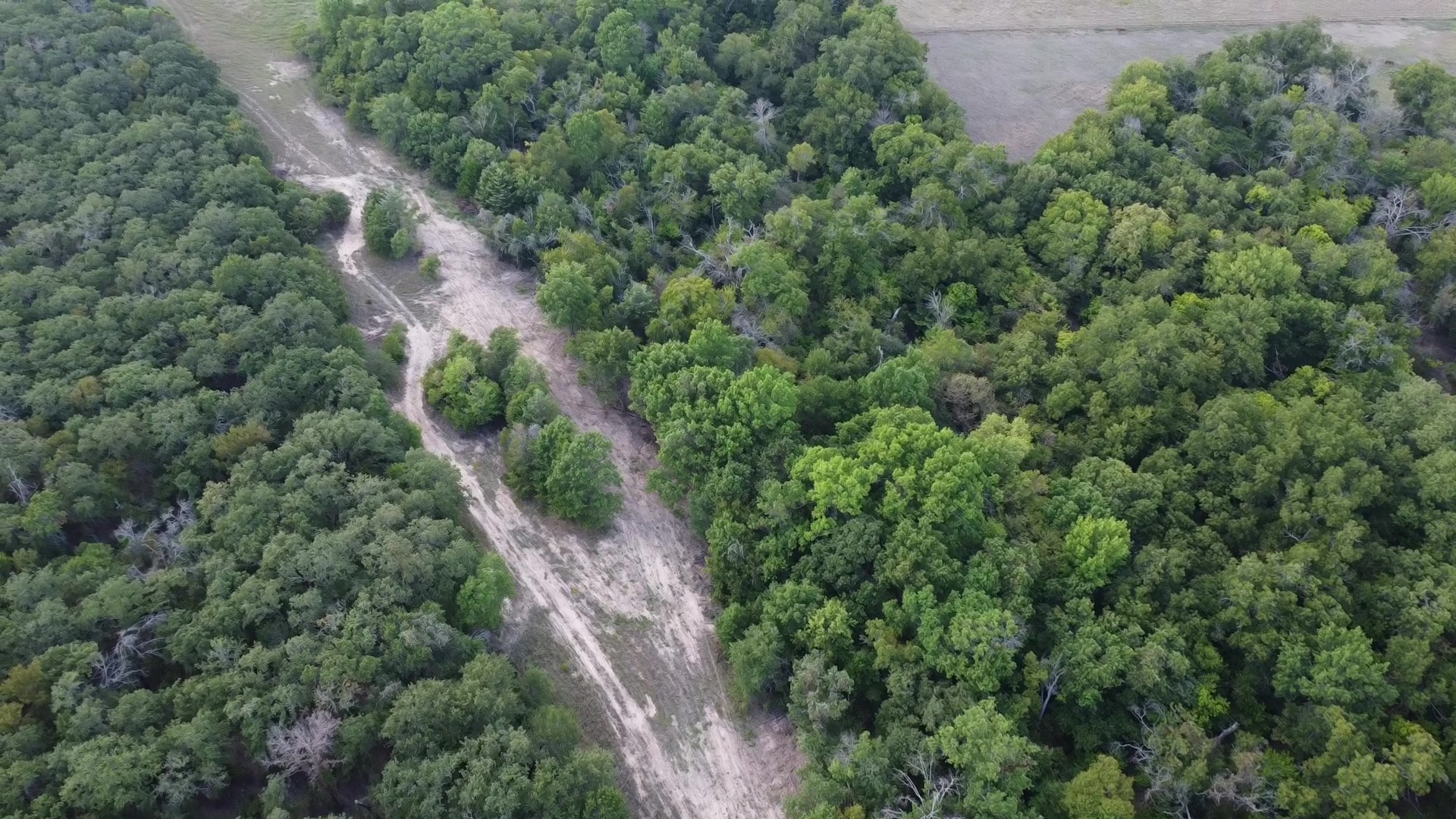
The creek cut from the drone's highest pass
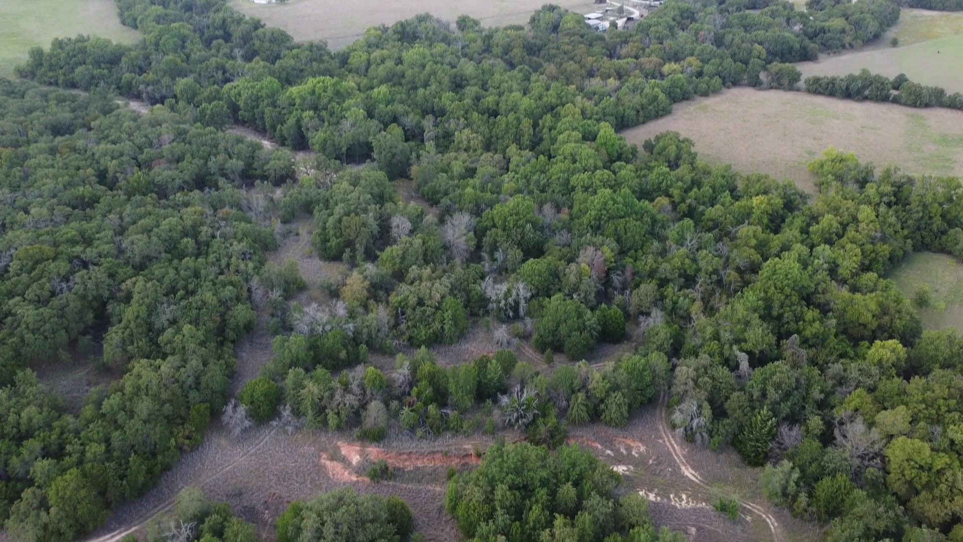
Red-dirt washes cutting through the property
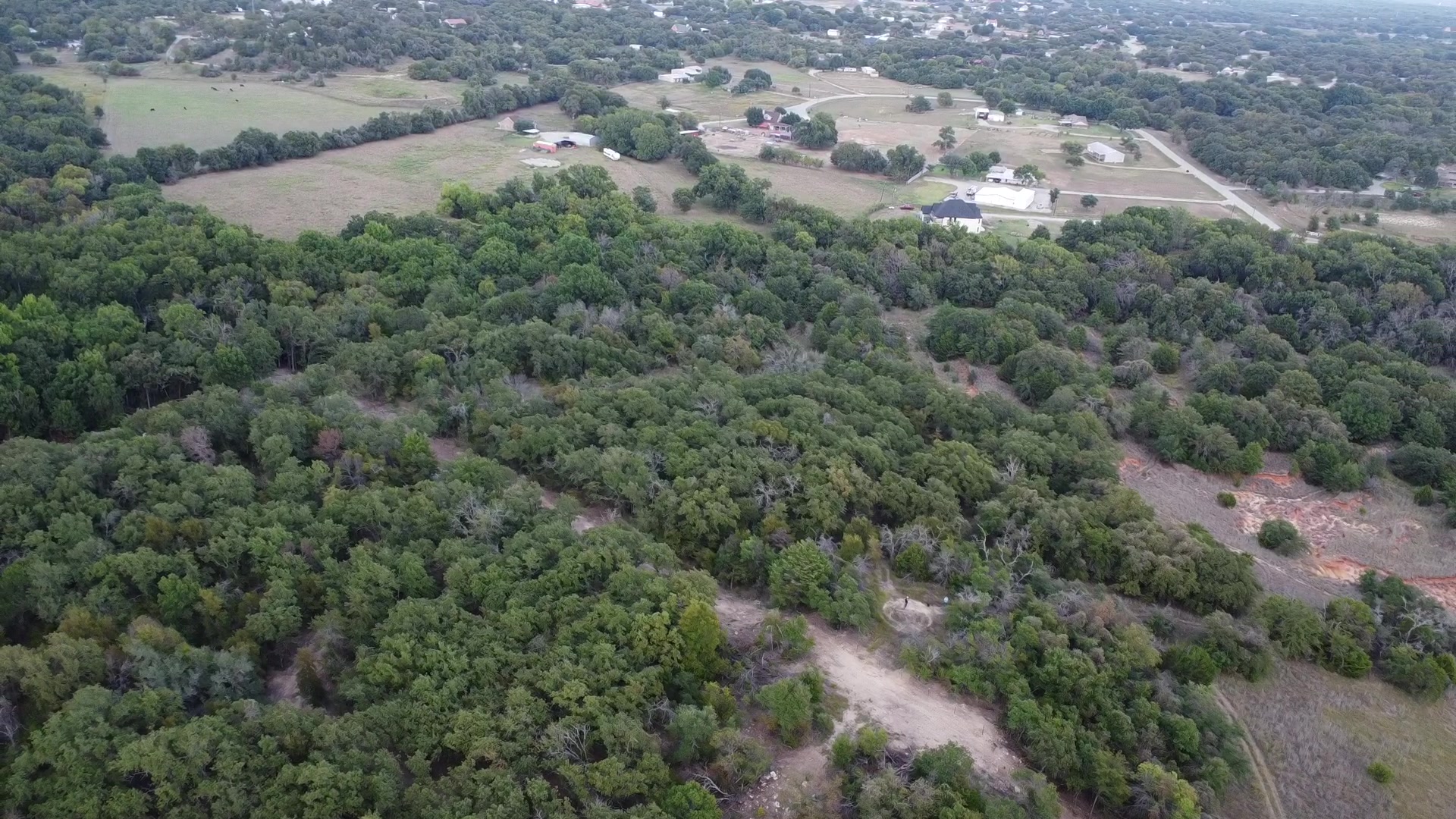
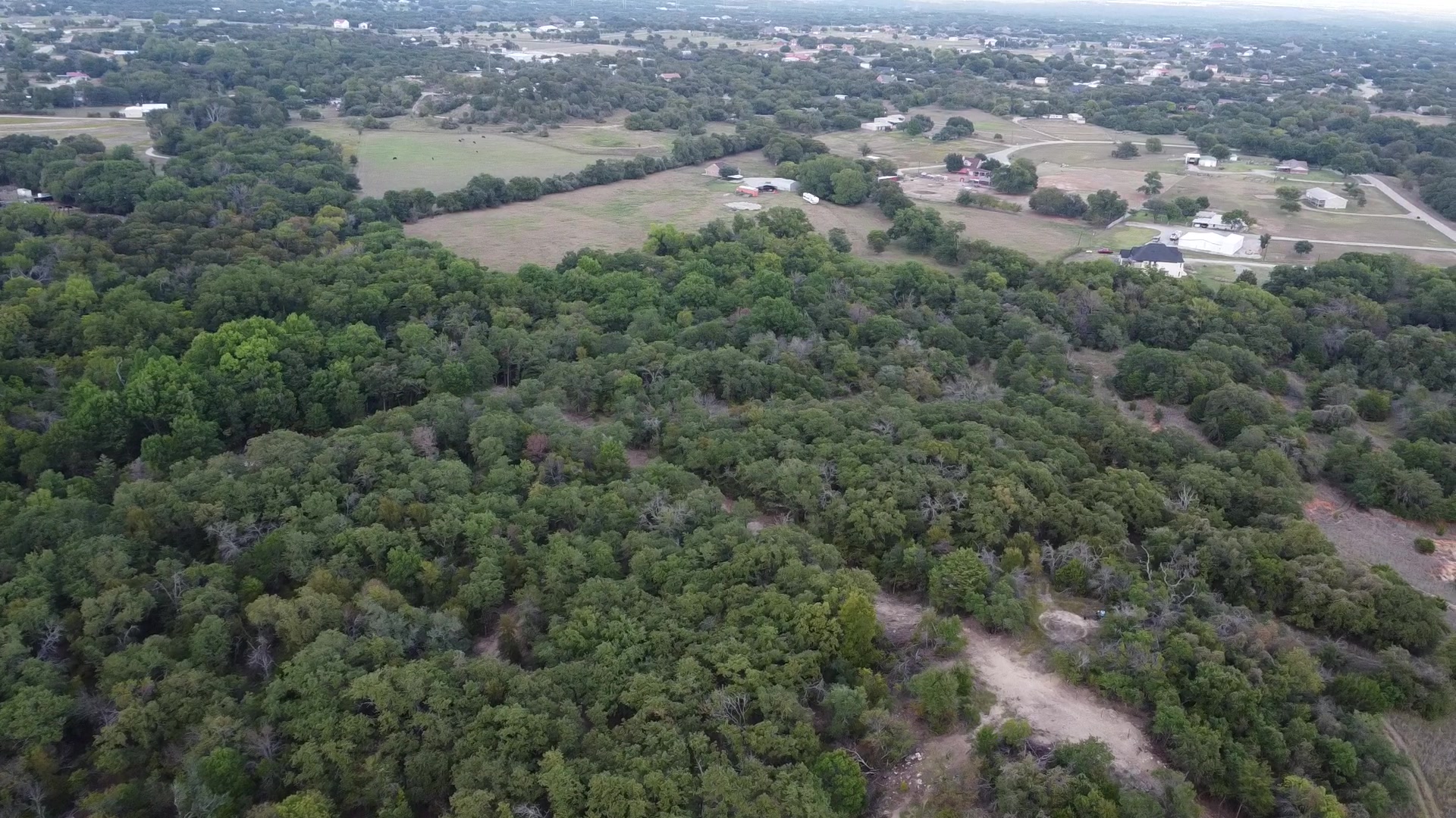
The ridge from 90 meters up — treetops to the horizon